Course Info
Please find course maps below. Keep in mind that all runners traverse the south portion of the course, while only the 50 Mile runners continue on to the north portion of the course.
You can see a Google Maps view of the event here.
Maps
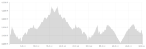
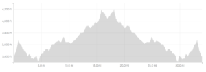
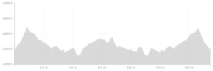
Elevation Profiles
- Colossal Vail 50 Miler – approximately 4,000 ft. of elevation gain
- Colossal Vail 55K – approximately 2,300 ft. of elevation gain:
- Colossal Vail Half Marathon – approximately 1,300 ft. of elevation gain:
Half-Marathon GPS Track
Description
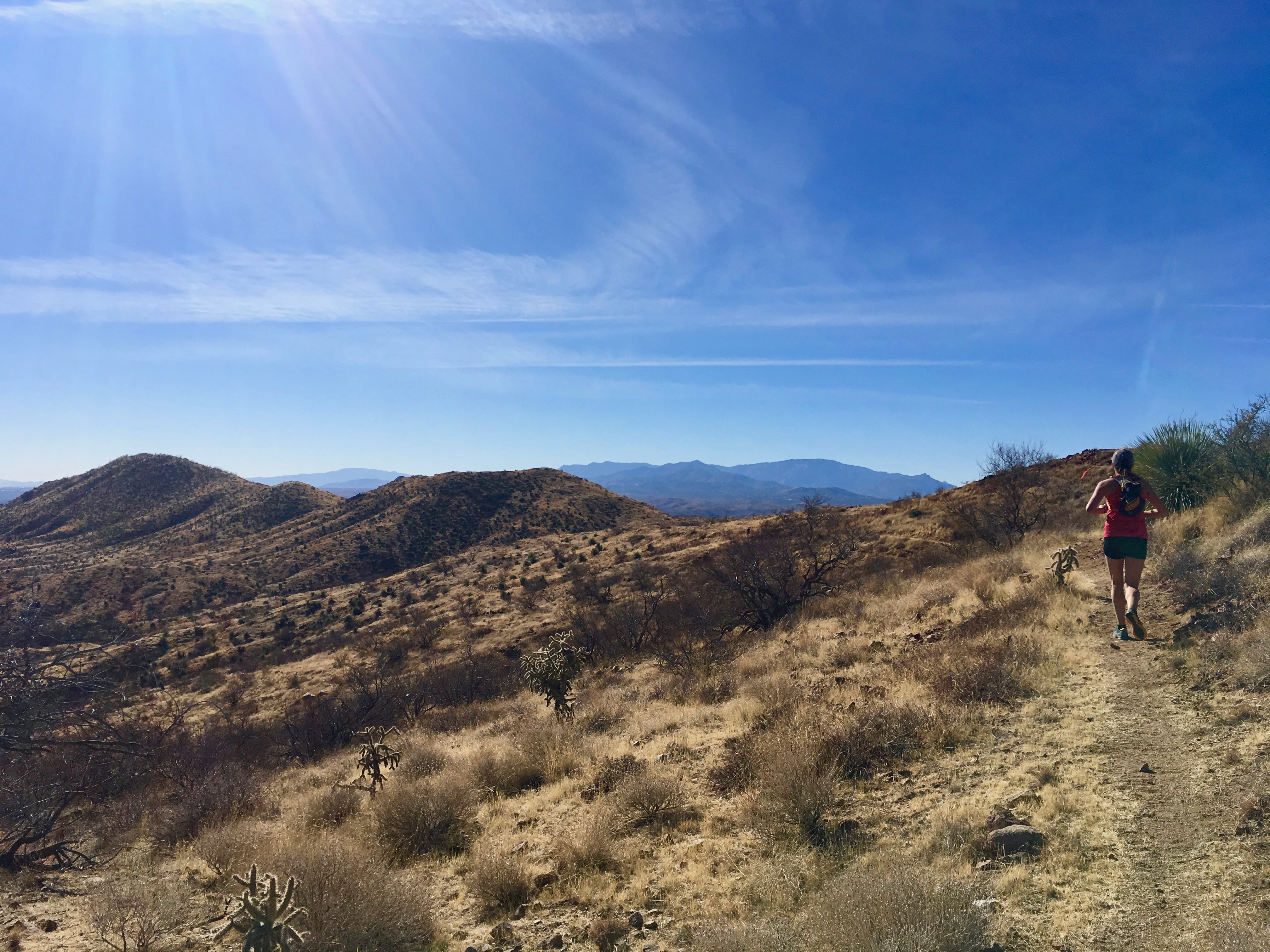
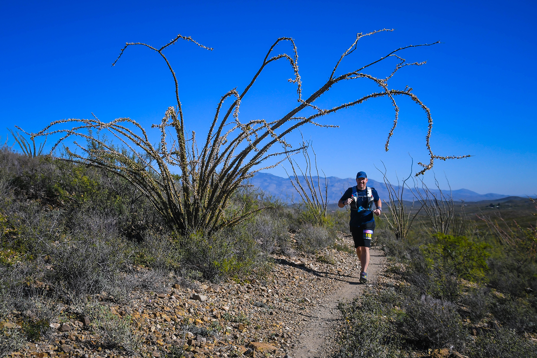
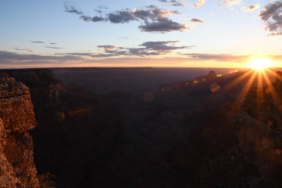
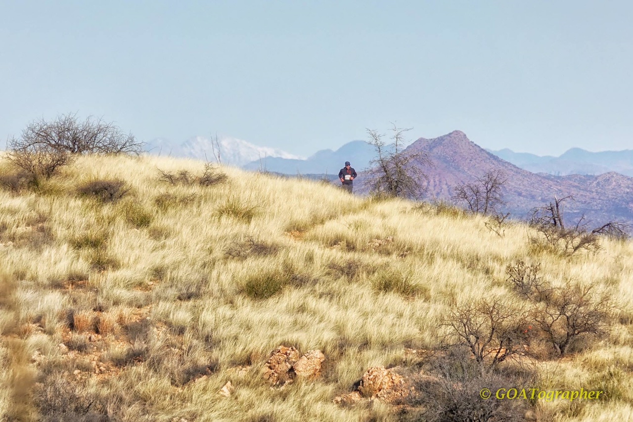
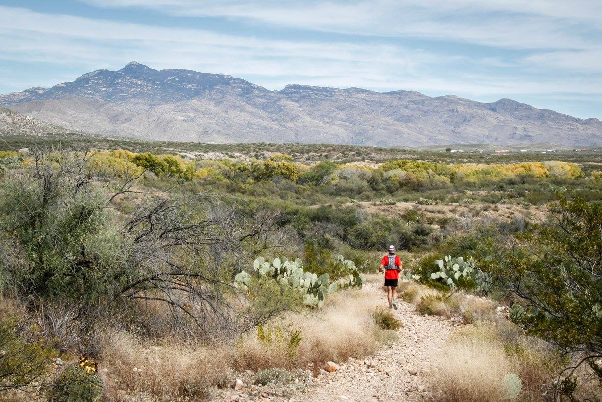
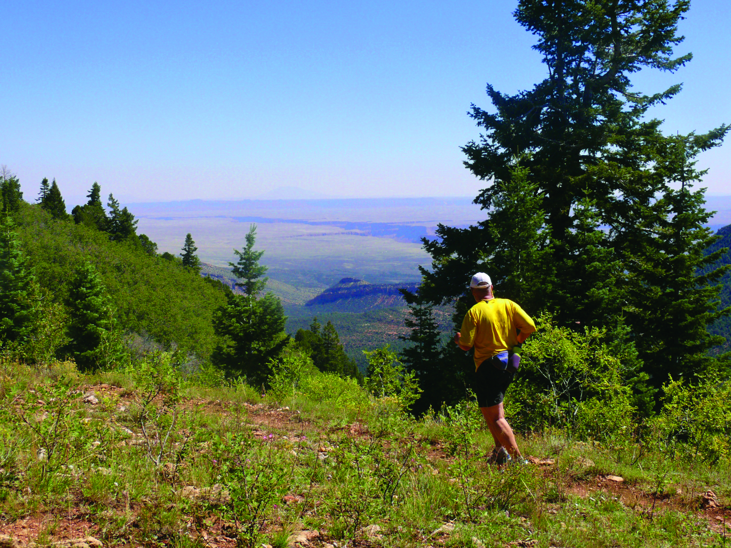
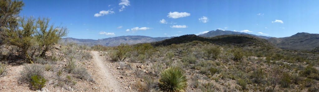
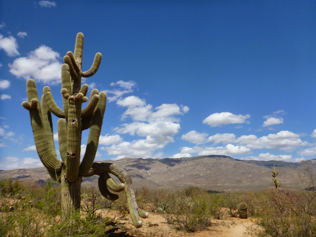
The Arizona Trail is divided into Passages. The CV 50/50 uses most of Passages 7 & 8, which link the Santa Rita Mountains south of the Tucson Basin to the Rincon Mountains on the east side of the Basin on the ancestral lands of the Tohono O’odham and Pascua Yaqui. Unlike some sections of the Arizona Trail that utilized existing trails, this was new trail built within the past 15 years. Parts of the trail skirt the east edge of the Sonoran Desert, where it is bordered by the Mexican Highlands, a transition zone to the Chihuahuan Desert, as well as some of the Sky Islands mountain ranges of southeast Arizona. You can find a great illustration of this here. These transitions mean the plant communities change depending on where you are on the course. At the north end, you’ll be running through saguaro cacti forest near the boundary of Saguaro National Park. Below the Gabe Zimmerman Davidson Canyon Trailhead, the saguaros disappear and more often you’ll run past yuccas, with the occasional juniper at unusually low elevations for those trees. The scenery is varied and beautiful. You’ll see massive mountain ranges all around you, some vistas quite spectacular. While the course is relatively flat compared to our trails in the nearby mountains, the 55K still has a total of almost 3,000 feet of climb and the 50-mile has an additional 1,000. There are few straight, completely flat sections on this course, which is overall excellent running.
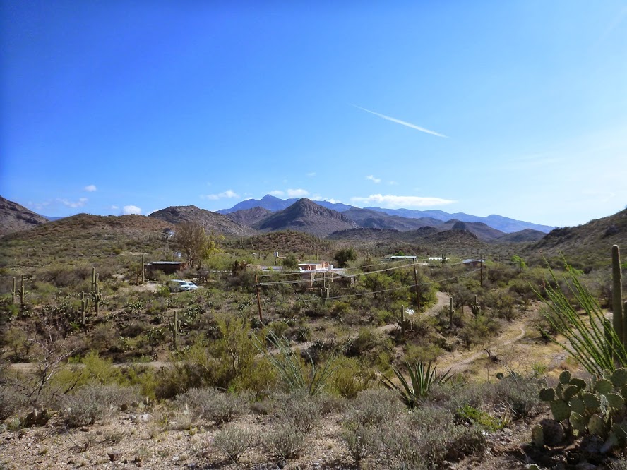
The CV 50/50 starts and finishes at La Posta Quemada (LPQ) Ranch in Colossal Cave Mountain Park (CCMP). It offers three distances, a 50-Mile, 55K (34 miles), a long Half-Marathon (13.6 miles), and a nighttime half-marathon (13.1 miles). All events feature an out-and-back course.
From the Start/Finish near the ranch entrance, both 55K and 50-Mile runners will go uphill 0.23 miles to intersect the actual Arizona Trail. Right turn (south) takes you up out of Posta Quemada Canyon, toward Cienega Creek. You’ll cross some small canyons through some interesting limestone formations. Look for the castle up on the hill to your left (east).
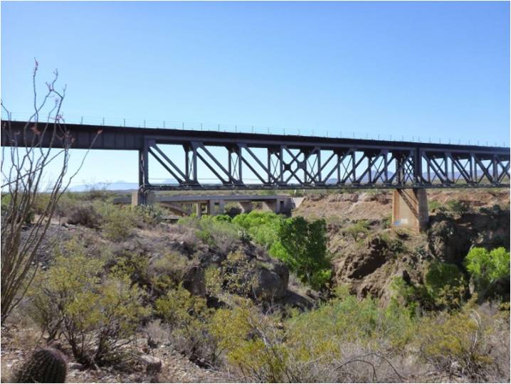
The route flattens out for a bit before you will encounter another canyon crossing at the first gas pipeline. Near Cienega Creek, you’ll start to get some great views of this beautiful riparian area. You’ll cross under the upper railroad bridge, the first of the Three Bridges. There you’ll cross Marsh Station Road just north of the vehicle bridge, proceed east and north, then turn south and drop into the bottom of Cienega Creek, the course low point at 3300 feet. Follow the markers under the lower railroad bridge, start up Davidson Canyon, then climb out to the Gabe Z Trailhead. (Note: Except for the Arizona Trail pass-through where no permit is required, the Cienega Creek Natural Preserve is accessible by free permit only from Pima County). Here’s what you’ll see as you approach the Bridges:
Gabe Z Trailhead at 4.9 miles is the first aid station. From there you’ll head south.
Nice views of Davidson Canyon are to your left as you approach the I-10 tunnel. Do keep your eye out for the Chevy Nova in the canyon bottom. You’ll pass through the red pineapple cactus forest, and after 1.6 miles go under 1-10 via the tunnel. It’s dark. On the other side, you’ll cross some broad rolling country with vast vistas, trending south and uphill for 2.6 miles until you cross Old Vail Road. From there you go west to Highway 83, where there’s another (not so dark) tunnel.
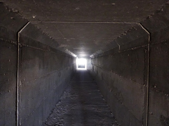
Under I-10
Continue south to the Sahuarita Road crossing and aid station, where you can have a drop bag. Please note that crew is no longer allowed at this aid station. You’ve come 11 miles. You’ll now make a relatively straight shot south and start climbing into the foothills of the Santa Rita Mountains. To your left (east) you’ll see the ridge of the Empire Mountains. You’ll cross several dirt roads, and then climb a ridge which is the high point on the course at 4,200 feet. As you swing around the ridge to a gate, you’ll see the high peaks of the Santa Ritas in the distance.
Drop off the ridge ~0.8 miles to the Peaks View aid station. Again there’s no crew access. You are now at the southern turn-around, 16.9 miles from the Start/Finish. On your return to the start/finish, you’ll pass through the same aid stations, first Sahuarita Road and then Gabe Z Trailhead. At Gabe Z Trailhead the 50K racers have just got the final 5 miles to La Posta Quemada Ranch. Here’s what you’ll see as you approach the ranch:
Upon arrival back at the ranch, the 50K and any 50-mile runners who wish to drop to the 50K distance will take the spur trail to the finish line. We’ll have someone directing traffic at that junction. Runners continuing to complete the 50-miler will turn right (north) and proceed 2 miles to the La Selvilla aid station. This is also the route for the nighttime half-marathon, which starts just like the other three races, but heads out-and-back on the 50-miler route, skipping the 50K out-and-back. You’ll see interesting views of Agua Verde Creek at the bottom of Posta Quemada Canyon as you travel up the canyon’s west flank. After the aid station the trail crosses the creek bottom and the road. From there, it continues to La Selvilla camping area, and then you’ll travel along the canyon east flank, crossing some roads and horse trails. You’ll climb up out of the canyon and see all three peaks of the Rincon Mountains—Tanque Verde, Mica, and Rincon.
You’ll reach Pistol Hill Road crossing and aid station 3.6 miles from La Selvilla. By now, you’ll have started the easy descent through the saguaro cactus forest to Rincon Creek. The trail is pretty twisty; please stay on course. At 1.7 miles, you’ll cross the private X9 Ranch Road. Exercise caution as we won’t have warning signs on the road and there could be traffic. This road is not open to the public. Crew attempting to meet a runner here could result in the runner being disqualified. Look for some strange saguaros shortly after you cross X-9. That’s Tanque Verde peak in the background.
From here, it’s 0.9 miles to the turnaround at N Colossal Cave Place. People will be there to meet you and turn you around. This is not an aid station, so you should plan to water up at Pistol Hill. You’ll be at the course low point. You’ll have travelled 41.7 miles. Now it’s just a matter of making your way back to La Posta Quemada Ranch with aid at Pistol Hill and La Selvilla.
